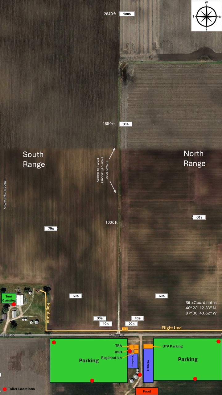
Pence field is located in open farm country in east central Indiana
About 20 miles Northeast of Danville Illinois
About 32 miles West and slightly south of Lafayette Indiana
About 95 miles Northwest of Indianapolis Indiana
About 100 miles South of Chicago
Enter Pence Indiana in your mapping app, it is a tiny village at the intersection of county roads 300 N and 1000 W (Jordan Street) .
When you get there, go due north on County Road 1000 W about 2 miles to the launch area. Parking is on the east side. Follow the signs
When you get there, go due north on County Road 1000 W about 2 miles to the launch area. Parking is on the east side. Follow the signs
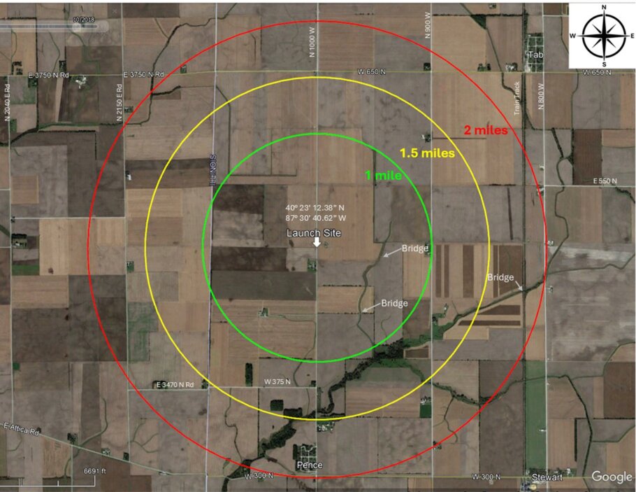
Coordinates to the launch site are
Latitude Longitude
DMS 40° 23' 18.406" N 87° 30' 37.576" W
DMM 40° 23.307' N 87° 30.626' W
DD 40.388446° -87.510438°
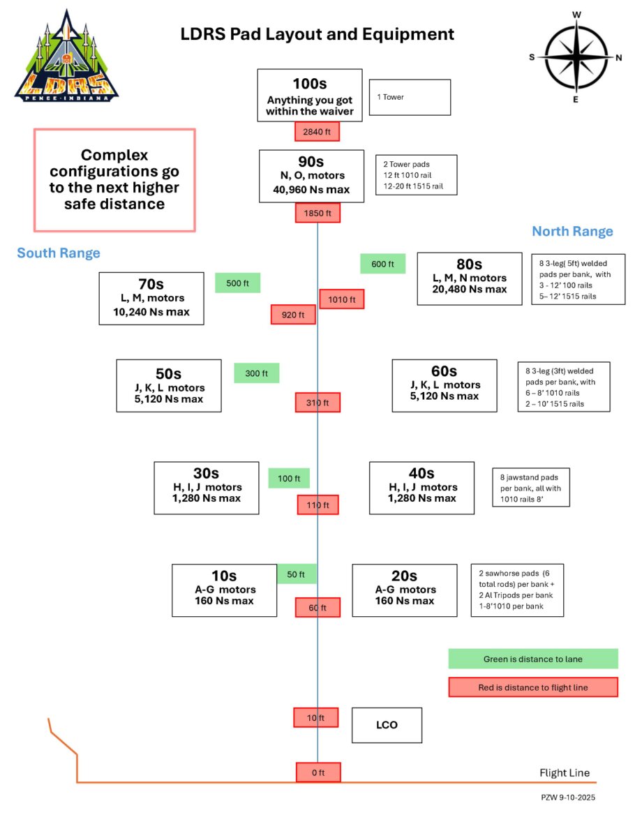
Click on a image to download a PDF file.